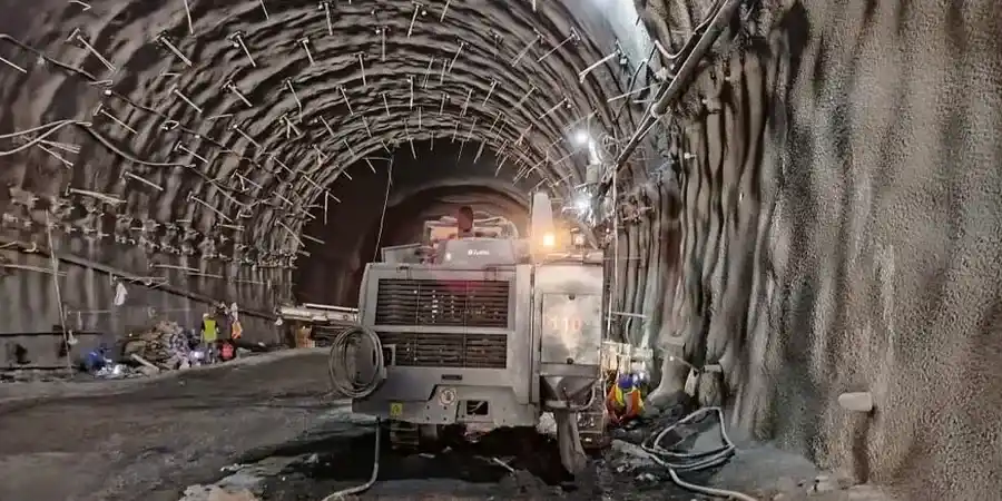
The application of CIRIA C760 and BS EN 1997-1:2004 takes on a particular edge in Peterborough, where the historic landscape of worked-out brick pits and the floodplain deposits of the River Nene create a patchwork of ground conditions that demand vigilance. When a cut extends beyond 3.0 m through the Oxford Clay Formation and into the underlying Kellaways Sands, the observational method stops being an option and becomes a contractual necessity. Our team deploys inclinometer strings, vibrating-wire piezometers, and automated total stations on sites from Fengate through to Hampton, ensuring that the design assumptions made at desktop stage hold true once the bucket starts stripping material. The data we collect feeds directly into back-analysis of retaining wall performance, allowing the temporary works designer to verify that the deep excavation support system is behaving within the predicted deformation envelope before a single prop is loaded beyond its serviceability limit.
In Peterborough's Oxford Clay, the critical window is the first 48 hours after a cut opens: if the face hasn't moved by then, the temporary works are performing as intended.
Our approach and scope
Site-specific factors
The contrast between Peterborough's summer drought periods and the prolonged wet winters introduces a groundwater regime that can trip up even experienced ground engineering teams. During the winter of 2020-21, the Environment Agency recorded groundwater levels in the Nene valley that were 0.8 m higher than the long-term average, enough to shift the effective stress state at the toe of a 5 m excavation by over 7 kPa. When that happens, basal heave becomes a credible failure mode in the lower-strength clays, and the monitoring array is the only thing standing between the site team and an unplanned collapse. We configure our piezometer alarm thresholds to account for seasonal recharge lag, so that a rapid rise in pore pressure behind the wall triggers an immediate review of the factor of safety against rotational slip, rather than waiting for the morning report when the damage may already be done.
Watch how it works
Regulatory framework
BS EN 1997-1:2004 (Eurocode 7: Geotechnical design – General rules), BS 5930:2015+A1:2020 (Code of practice for ground investigations), CIRIA C760 (Guidance on embedded retaining wall design), CIRIA C812 (Management of geotechnical monitoring data)
Linked services
Real-Time Deep Excavation Monitoring
Automated total stations track prism targets on the retaining wall and surrounding buildings at 15-minute intervals, with SMS and email alerts triggered when movement exceeds 75% of the agreed trigger value. Inclinometer and piezometer data streams are integrated into a single web-based dashboard accessible to the designer, the contractor, and the client's representative simultaneously.
Trigger Level Definition & Contingency Planning
We develop a three-tier alert system (green, amber, red) linked to specific ground movement and groundwater thresholds, defined in collaboration with the permanent works designer. Each alert tier carries a pre-agreed action: from increased reading frequency at amber through to stop-work authority and emergency propping at red.
Post-Construction Performance Verification
Instrumentation is maintained for an agreed period after backfilling to verify that long-term consolidation settlements are within the predicted range. This is particularly relevant for excavations adjacent to sensitive structures in Peterborough's city centre conservation areas, where post-construction movement claims can arise months after practical completion.
Typical parameters
Q&A
What does excavation monitoring cost for a typical Peterborough project?
For a straightforward cut of 3 to 5 metres depth with a single inclinometer string, three surface settlement lines, and two piezometers, the monitoring package — including installation, baseline readings, a four-week active monitoring period, and final report — falls in the range of £750 to £1,980. The final figure depends on the number of instrumented sections, whether automated or manual readings are needed, and the required reporting frequency. We offer a fixed-price proposal once we've seen the temporary works drawings and the geotechnical baseline report.
How often are readings taken during the excavation phase?
During active excavation, we take inclinometer and settlement readings daily as a minimum, with the automated total station cycling every 15 to 30 minutes if real-time monitoring is specified. The frequency steps down to twice weekly once excavation reaches formation level and the wall movement rate drops below 0.5 mm per day over three consecutive readings. The exact schedule is locked into the project-specific monitoring plan and signed off by the Temporary Works Coordinator before any instrument is installed.
What are the trigger levels and who sets them?
Trigger levels are defined jointly by our monitoring team and the temporary works designer, based on the serviceability limit state (SLS) predictions from the retaining wall design model. Typically, the green threshold allows movement up to 50% of the predicted SLS deflection, amber sits at 75%, and red at 100% of the SLS value. These values are written into the monitoring specification before the first cut, and any exceedance triggers an immediate notification to the designer and the Temporary Works Coordinator, with a pre-agreed escalation protocol that can include stopping work if the red threshold is breached.